Is there much of a difference between the 10 and 12 clarity wise? i would think the 12 to be better on a normal basis.Originally Posted by Crappie Chatt


Is there much of a difference between the 10 and 12 clarity wise? i would think the 12 to be better on a normal basis.

I think the 'performance' between the units is too close of a call. Ease of use, Touch wins in a landslide. And ofcourse '12'. I'll be posting some more shots of the HDI transducer & I'll post another StructureScan on speed. <*)}}}><

Pods of baitfish out on the great lakes
Pod of bait with fish feeding underneath
Baitfish in the harbor
More bait
Here is a boat I recently found at one of the old strip mines in the area...
Sonar0002_track_1.jpgSonar0002.jpg
Then some Concrete slabs buried under the mud.
Incline 1 burried concrete slabs.jpg
jigging salmon.jpg
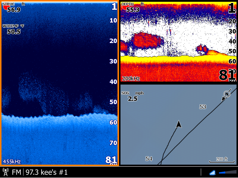
I posted this screen capture because of all the information in each of the views.
We were jigging for Salmon on the Mokelumne River.
Recent screenshot from the 3D transducer
HDS Page LayoutsUnderstand that you have two(2) StructureScan layout pages:
The Main Pages Selection StructureScan image is always PAGE-ONE. I always leave this StructureScan(SS).
When you create a Page Layout:1st StructureScan dragged becomes PAGE-ONE in the layout. Since it is PAGE-ONE it will always match the Main Pages Selection of SS or DI.
I always leave PAGE-ONE to be StructureScan(SS).
2nd StructureScan dragged becomes PAGE-TWO in the layout. Always set it opposite of PAGE-ONE.
I always set PAGE-TWO to be Down Image(DI).
Example of a Favorite Layout of a "FULL-SCREEN DI screen":
1st drag StructureScan creating the StructureScan PAGE-ONE.
2nd drag StructureScan creating the StructureScan PAGE-TWO. Verify or make it DI.
Now remove PAGE-ONE by dragging out of the layout.
Save this "FULL-SCREEN DI" Favorite Layout.
QED
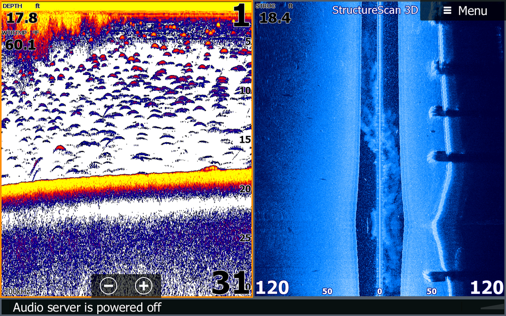
Some recent screenshots from a structuremap I made recently on a new part of a lake I fish. This technology easily shows the transitions from soft to hard bottom and easily picks out structure. Great tool to have!

Just bought an 04 Skeeter that has a Lowrance HDS5 at the console. It doesn't have a side scan transducer or temp. Can I get both in one ducer or do I have to buy both?


No, you have to buy seperate ducers if you want sonar and structure scan.
YOU are not entitled to what I have earned!!!!!
2014 Phoenix 619 Pro / 2014 Mercury 200 Pro XS
Hello , Looking for a little help here Have a hds 9 gen 2 at console and everytime i use my 2d sonar i never see Archs its looks like weeds on the bottom. I know there fish there because ill get them but i can never scan on my 2d cause it always looks the same. Just curious if anyone has any tips. I'm new to lowrance and tryed alot of different settings etc.
any info would be great

[QUOTE=fishin couillon;1547064]Transferring waypoints from card to unit.
in the SI pic are all those lines purely caused by the jackplate?
[/QUOTE
Are those lines in the SI pic purely caused by the jackplate?
2018 TRX 18. 2020 Mercury 200 Pro XS V8
Yes, both DownScan and SideScan signals bounce in an open jackplate. Images greatly improve with a hole shot plate.
As Marc said, yes they are caused by jackplate.....the brand of jackplate i had on that particular boat did not have a hole shot plate nor did they make one. I ended up buying the TSS bracket and shield which lowered the ducer and got rid of the interference.
YOU are not entitled to what I have earned!!!!!
Hello all. Wondering if anyone can help with a Lawrence Elite 7HDI. I purchased a used boat and have been storing it in my yard until my marina opens up. Figured I would play around with the chart and make a waypoint for the marina. When I zoomed in on the area, the map was inaccurate. showing water where there is landIMG_6068.JPG(sorry I could not rotate the pic). this is what is should look likeIMG_6091.JPG
Has any one had something similar? I performed a hard reset and updated the software to the latest version. Wondering if the boat being located approximately 40 miles from the waypoint area has anything to do with it? After review, most of the coast line is way off and no way would I be able to have the chart assist in navigation. Im hoping the chart corrects itself when I get it in the marina. If not, the chart is useless and I need to replace the unit. If there is no fix for this issue, does a navtronics card use its own map and points or does it overlay new points on the units map? Don't want to waste the money if I will still have the same issue. Any suggestions would be appreciated

Welcome aboard Mathew.
I would try starting a new thread.
" Talking to you is like clapping with one hand "
Anthrax
I bought new HDS lives, mounted transducer in same place as HDS Gen 3 (not on the jackplate) and have these lines on the left side of my active imaging 3-n- 1 ducer.
i found that the charts that come with lowrance are very poor.
i have had Gen 3 and currently Carbon models.
i went with Navionics sd card and have been very pleased with the detail.
they also give a Satellite view of your area so they are pretty accurate.
check out their web site.
john
Has anyone seen this issue on an HDS Live? Notice how the slanted lines appear to go below the bottom. I have an HDS 7 on the bow and HDS 9 at the console. Networked with NMEA and LAN. The diagonal lines appear only when the HDS 7 is on, and the lines appear on both screens slanted the opposite direction. When I turn off the HDS 7, the slanted lines go away on the HDS 9. If I use the bow transducer networked to my console HDS 9, no lines. (Transducer in the bow is whatever comes with Lowrance Ghost trolling motor. ). Hoping someone has seen this and knows the issue before I charge the windmill at Lowrance. Thanks.
B4BF50FA-AA44-401E-98C7-66B1173C319D.jpeg
Running the same frequency?
Then you will get cross talk.


 Reply With Quote


