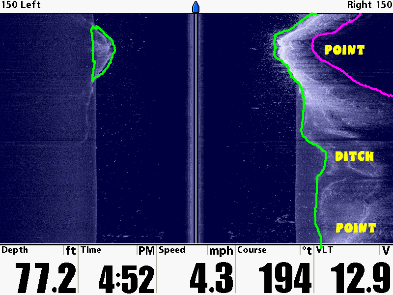
This might help. The pink line is the end of the water since the bluff extends out of the water from the pink line it cant scan. From the Pink Line to the Green Line is the underwater portion of the bluff and at the top I drove over a point on the bluff wall so it showed up on the left side. I labelled two points I see on the bluff and a depression that I call a ditch.
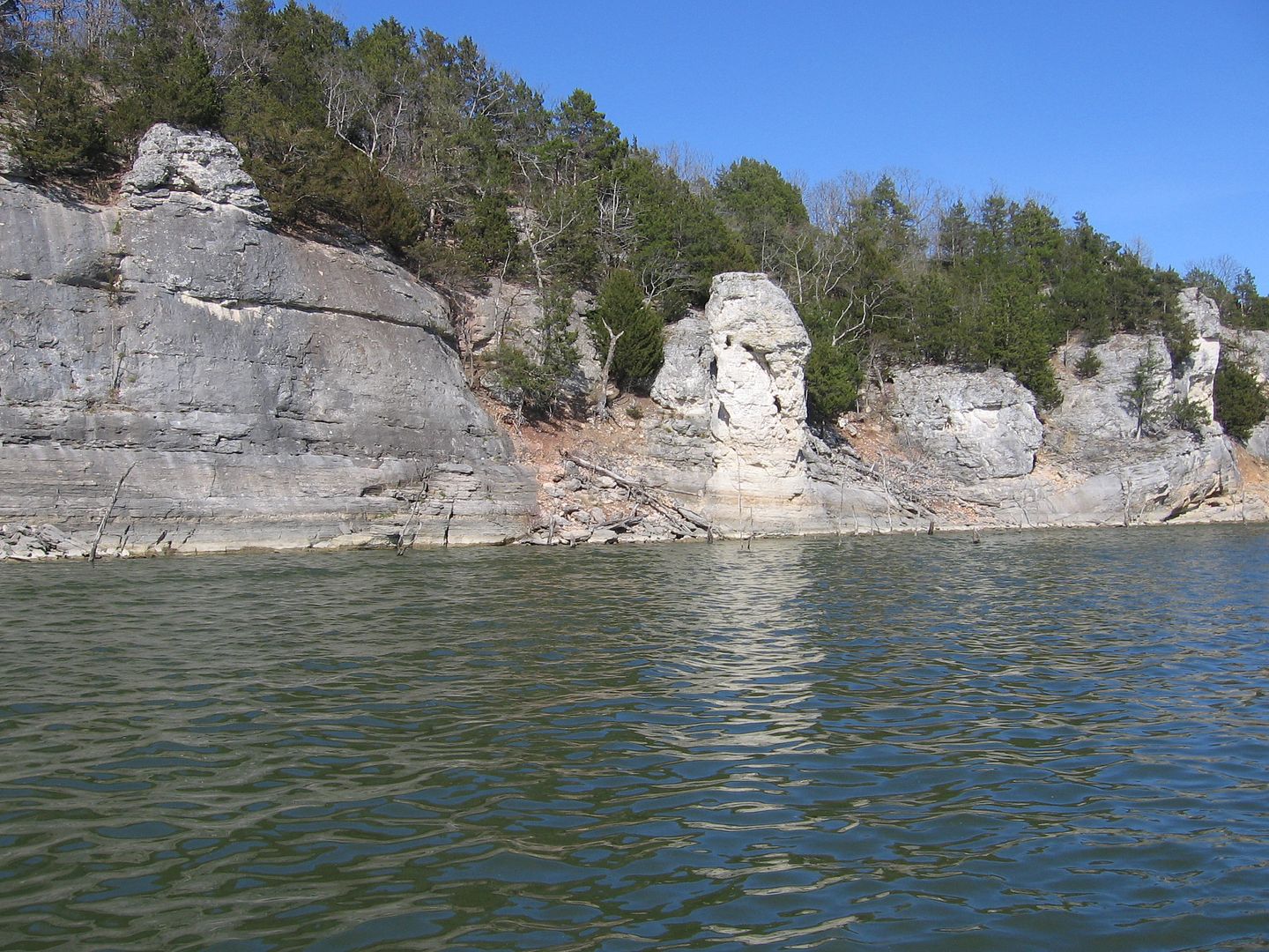
Here is an example of a Bluff out of water and you could see similar structure under the water.
Hope this helps.


 Reply With Quote