Anybody got any ideas?


Anybody got any ideas?
Thats some big worms or snakes LOL
2020 BassChamps Central Lake Belton 1st - Feb 2
2019 Media Bass Individual Champion - Richland Chambers Sep 7-8
2019 CAST Champions - Sam Rayburn Oct 19-20
2011 BassChamps East Region Champions-Sam Rayburn Oct 1-2
2020 Bullet 21XRS 2020 Mercury 250 ProXS 4 Stroke
Texas Realtor
Helping Texans buy and Sell their Homes
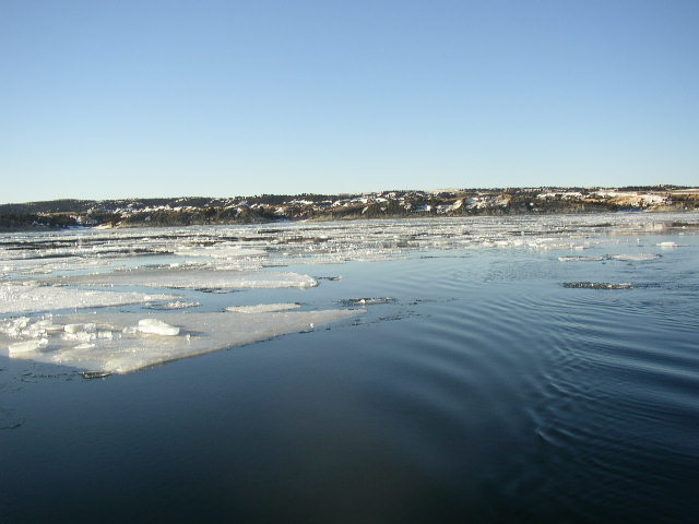
Ice slabs
Gregg Ebert
I agree with greg, its ICE
i dont really see how its ice, unless it sank. but the water temp makes me think they are right.
I'll say ice and we all know ice doesn't sink. If it's ice it's a good example of the fact that sonar can only measure distance and doesn't know the difference between 20 ft straight down and 20 ft to the left.
<table width="90%" cellspacing=0 cellpadding=0 align=center><tr><td>Quote, originally posted by countryboycansurvive »</td></tr><tr><td class="quote">I'll say ice and we all know ice doesn't sink. </td></tr></table>
I disagree, I've seen plenty of sheets of ice sink on the lake....happens every year up here.
Right on about the ice, good call guys, especially the one from Ca!
Gregg, I think you had a little more data available than the others.

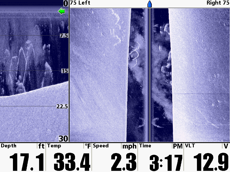
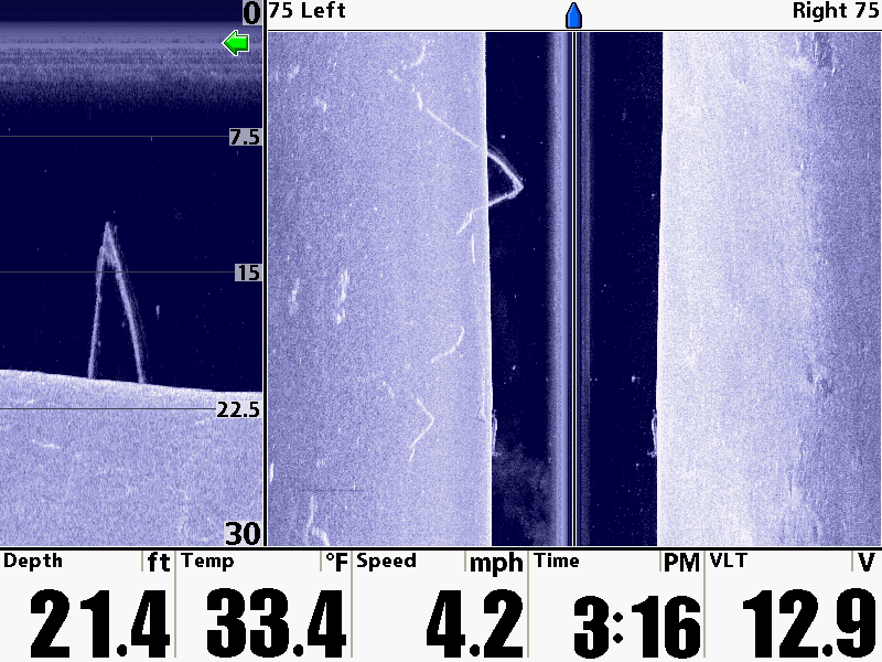
is this
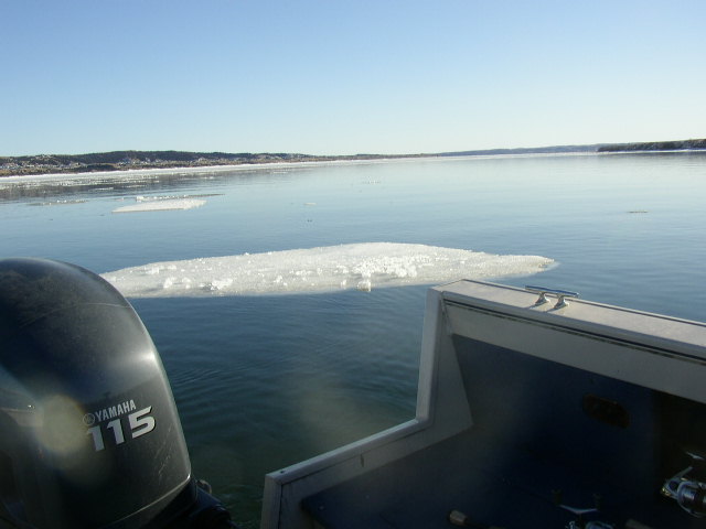
and the second one is this.(although this picture is of the right side of the boat, the left was the same.
Now, the next thing you are going to say is well, thats BS that something floating on top of the ice, would show up in DI like its down 20 some feet.
That was my initial feeling 3 weeks ago when I experienced this . So, rather than just fire off a post on a message board about how this could possibly happen, like I wanted to, I took it directly to the head guys at Humminbird, Greg Walters and Mark Gibson.
What I originally thought was a posible glitch in the system, actually is a feature!
If you have your Down Imaging beam set to wide, it will show everything from the surface down that the unit picks up, thats why the floating ice shows up in the down imaging screen.
If you set the down imaging beam to narrow, it will only look at a zone that is below the boat, and the ice would not have shown up in the DI screen.
Makes perfect sense, I think.
Now, with that said, it not very often that you are going to have alot of targets on the surface so I think I may still run it in wide, now that I know what it does,but I will definitely play with the wide narrow DI beam next time I am out.
Hopefully the ice disappears and is a non issue anymore :wink
Edited: Pretty good observation countyboy. its all about the settings
I never see snow or ice where im from, but on your 2nd pic and your water temp and the clouds in the water just gave it away
If you have a recording of this you could play it back with the three different selections of down imaging width and post some more pics. I'd be curious to see the difference. I typically keep my DI set to narrow, makes for better images in my opinion.
no recording, but hope to have updates shots next time on the water.
Great work 91reddog, I've always used wide setting with DI & will now play with narrow.
Sorry I raised my hand,
Gregg Ebert
No problem Greg. I'm PMing you my cell number. lets chat
Sometimes it takes some messing around to figure out eactly what these features are and when and where to implement them.
Gonna try Sunday-Tues. if for no other reason than to get my boat back to the cabin. I brought it home to rig a new Terrova IPilot 36-101 and cant wait to get back on the water.

Nice image. I took my 1198 out for the first time last sunday and the ice looked different on mine it kind of glowed on the surface with the side image on.
To bad they cant see forward because I smacked a huge chunk in the dark good thing I was going slow.
Randy
http://www.scvwl.com
2013 Ranger 620VS Yamaha 250 and Yamaha 9.9 kicker
Now my brain is busted. Only a couple weeks old in this SI / DI ciphering stuff. How does ice make that 10ft arch, aurora looking image? Trying to understand the mechanics of what the soundings show. If it's a chunk of ice at the bottom then shouldn't it be a solid image roughly the shape of the ice? Now I'm lost. Glad I live in S. Louisiana where I'll never see that one.
Just had a thought. Maybe the more solid ice is void of bubbles and so does not impede the sonar signal (therefore clear) and the edges return a slight ghostly signal. Or maybe not.
It is the shape of the ice in DI. The DI beam cannot see the backside of the ice chunk, thats why its open ended at the bottom. The reason it even shows up is because the Di beam was set to wide, so it shows everything from the surface down,(measured at the distance from the boat) in the Di view.
When I changed the DI beam to Medium or Narrow, then it doesnt show up in the DI screen.
I think I understand. Just the surface facing the transducer shows up.

Correct SI can't go around corners so it like a flashlight and a mirror once the beam hits an object it returns back to the transducer.
--
http://www.dougvahrenberg.com/
BASS Central Open- Competitive Bass Angler and Humminbird Guru
Visit my website to learn about my sponsor's products, fishing tips and techniques.
Learn More About Humminbird Side Imaging Visit: http://groups.yahoo.com/group/sideimaginggroup/


 Reply With Quote