1) Can the Ultra high def transducer be used for QuickDraw contours ?
2) Does the process of quick drawing contours over write the existing preloaded charts ?
3) Once a QuickDraw area has been mapped, how do you access it in the future ??


1) Can the Ultra high def transducer be used for QuickDraw contours ?
2) Does the process of quick drawing contours over write the existing preloaded charts ?
3) Once a QuickDraw area has been mapped, how do you access it in the future ??

1 - I dont have answer for that.
2 - No
3 - It stores the files on your SD card that you have in the unit. Before you start the QD you can set the unit and name the file for each body of water you are on. I think if you go back to same body of water you can recall that lake from the list and add contours to it.
If you have AC setup you can chose to have the file(s) uploaded to the QD community automatically thru the wifi on unit and phone/tablet.
YOU are not entitled to what I have earned!!!!!
2014 Phoenix 619 Pro / 2014 Mercury 200 Pro XS
I didn't know you could name each individual lake. For lakes I've already mapped, can they now be named?
I would think you can as long as you created separate files....I’ve been on 3 bodies of water and named each one, I think I can “call” it back up to add more contours to....if I’m wrong someone will correct me.
YOU are not entitled to what I have earned!!!!!
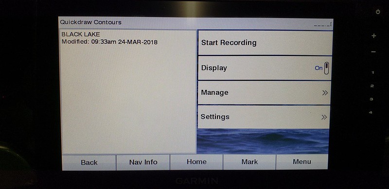
Ok, i looked at mine this evening, i do have it named but i know that at the other places i went to i named those also but i only see one name (see pic below) BUT all the frames/boxes show up under Black Lake......so maybe i'm wrong as far as labeling each lake....might have to be a call to Garmin or someone on here with more knowledge.....
YOU are not entitled to what I have earned!!!!!

Yes, the GT34UHD transducer can be used to generate QD contours.
Garmin Pro Team
I have a question about changing the depth. Once mapped can the contour depth be changed. I had an offset for the lake when it was ten foot low before I ever tried quickdraw then after mapping a large area it is off by ten foot. Cannot figure out how to change it or delete it and start over. If I cannot change how do I delete it and start over?
- Try keel offset, it might change the depths to what you currently have.
- Remap it, this will overwrite old QuickDraw info.
- In regards to deleting, it's all or none.
See User Display OffsetOriginally Posted by shelfish

quickdraw settings.JPG
Garmin Pro Team


 Reply With Quote