Results 1 to 17 of 17
  1. #1
    Member steelebob's Avatar
    Join Date
    Mar 2013
    Location
    Canterbury, NH
    Posts
    175

    HUMMINBIRD LakeMaster Chart Northeast and Contour Elite

    Can anyone comment on either HUMMINBIRD LakeMaster Chart Northeast OR Contour Elite computer mapping system. Reviews of the HUMMINBIRD LakeMaster Charts of other editions (different areas in the US) are all other the place. I have Navionics for my Humm 898 and am wondering if either one would be more usefull??? For both I'm looking at around $200.00.

  2. Member
    Join Date
    Feb 2014
    Location
    raymond, nh
    Posts
    2,717
    #2
    I toyed with the same idea in the spring. From what I learned I don't think either would be much more beneficial for our area compared to a new navionics plus chip. I ended up buying the nav + chip for my mega 9 and it is way better than my old chip for my 798. I think a lot depends on what lakes you fish. There is some better detail from what I saw on some of the bigger nh lakes and you can eliminate water that don't match your criteria but I really don't know what that is really worth..... as a weekend warrior the newer updated nav chip was more than I needed. I do a ton of offshore hump fishing and it provided me with enough guidance to find and map out structure to where I could find and catch fish. Maybe I am behind the curve but I saw no benefit from it....

  3. Moderator TMG's Avatar
    Join Date
    Apr 2006
    Location
    New Hampshire
    Posts
    32,021
    #3
    No idea about hummingbird mapping.
    I just started messing around with making my own maps with navionics and lowrance.
    Wow is that cool. I would sonar chart live the area then structure map it.
    I can't wait to get out and do some more
    Do you guys do any live mapping ?
    " Talking to you is like clapping with one hand "
    Anthrax

  4. Member
    Join Date
    Feb 2014
    Location
    raymond, nh
    Posts
    2,717
    #4
    I messed around with the auto chart live function a little bit. Pretty cool feature. I spent most of this summer really learning how to dial in my unit. Would like to use it more this year.

  5. Member
    Join Date
    Apr 2016
    Location
    Maine
    Posts
    116
    #5
    I’ve got the lakemaster chip and navionics plus like both and run both at times on dual graphs the lakemaster has better color shading for depth changes so it can help find humps of different depths in color. Downside of lakemaster is up here in Maine not many lakes are mapped so if you fish Maine a lot get navionics

  6. Member
    Join Date
    Jul 2006
    Location
    Chapin, SC
    Posts
    780
    #6
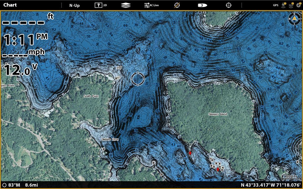
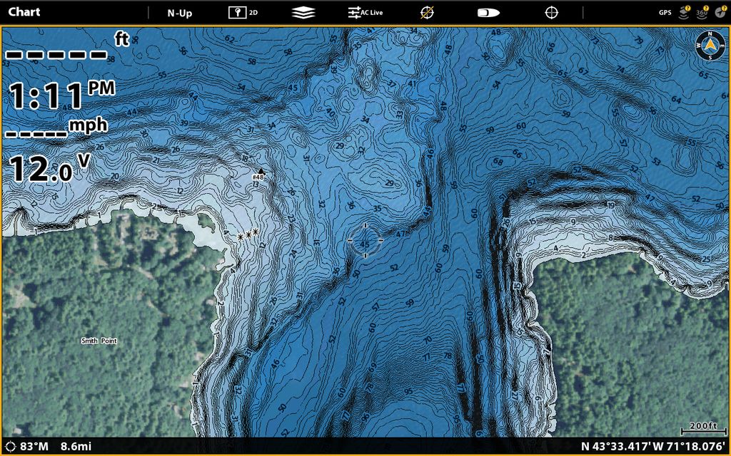
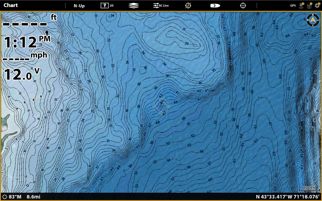
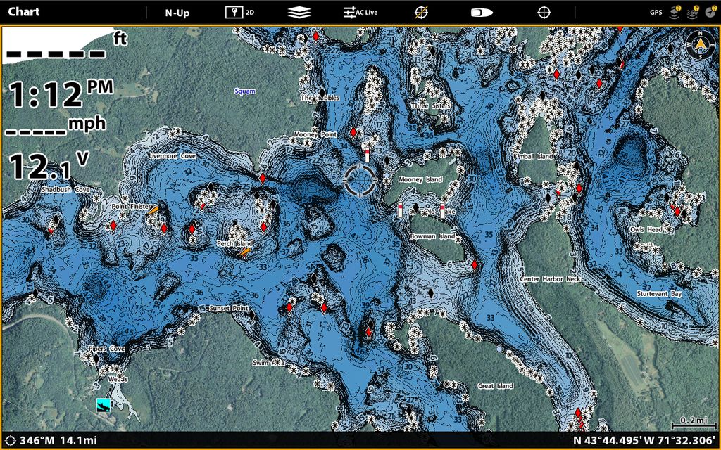
    If you fish Winni, Winnisquam, Squam, Newfound or Ossipee, you'll really like Lakemaster.

    Just a FYI, the Lakemaster team took a full month to properly survey Winni and went through a pallet of props and lower units in the process.
    They wrecked the boats on that lake. :)

    I'll upload some screen shots from local lakes
    Last edited by OThessalonikios; 01-04-2018 at 10:49 AM.

  7. Member
    Join Date
    Jul 2006
    Location
    Chapin, SC
    Posts
    780
    #7

  8. Member
    Join Date
    Jul 2006
    Location
    Chapin, SC
    Posts
    780
    #8
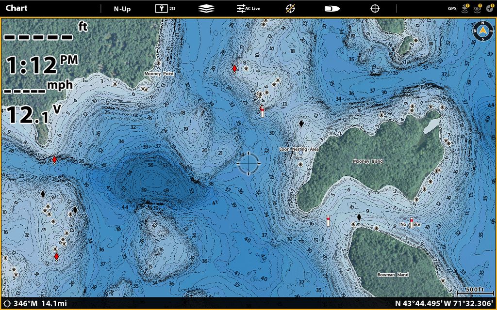
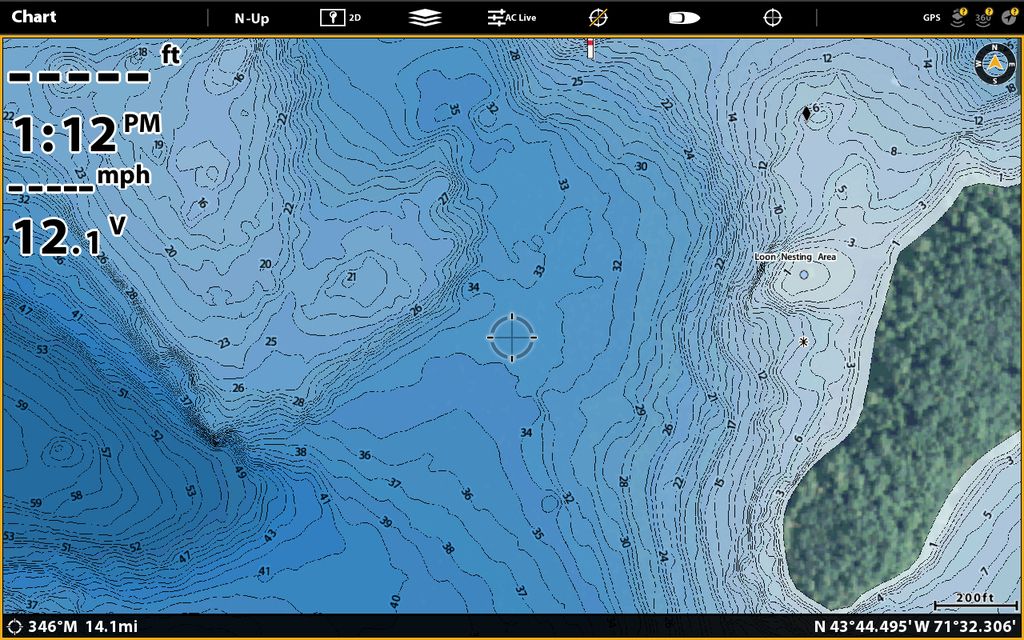
    Winni. I'll zoom in on the area a few times


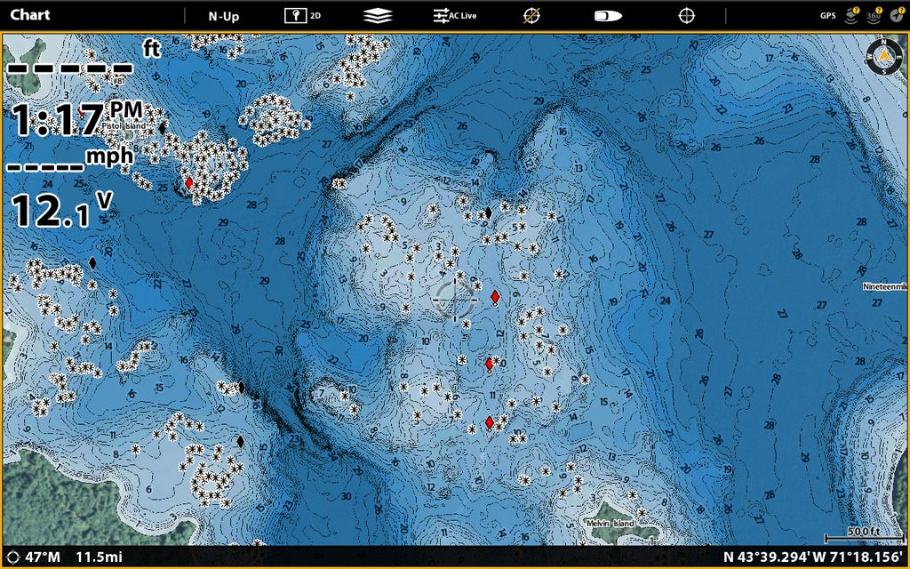
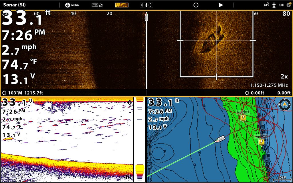
    Graveyard. Each star is a rock they either hit or marked:


  9. Member
    Join Date
    Jul 2006
    Location
    Chapin, SC
    Posts
    780
    #9
    Squam


  10. Moderator TMG's Avatar
    Join Date
    Apr 2006
    Location
    New Hampshire
    Posts
    32,021
    #10
    Unfortunately we can't ....or I can't see your pics.
    Photobucket makes you pay to host your pics now.
    " Talking to you is like clapping with one hand "
    Anthrax

  11. Member
    Join Date
    Jul 2006
    Location
    Chapin, SC
    Posts
    780
    #11
    I'll try again.

    Winnipesaukee. An area we should all know around West Alton


    The Graveyard below.


    Let me know if these worked.
    Last edited by OThessalonikios; 01-04-2018 at 01:49 PM.

  12. Moderator TMG's Avatar
    Join Date
    Apr 2006
    Location
    New Hampshire
    Posts
    32,021
    #12
    Quote Originally Posted by OThessalonikios View Post
    I'll try again.

    Winnipesaukee. An area we should all know around West Alton


    The Graveyard below.


    Let me know if these worked.

    That worked great , thanks for posting
    " Talking to you is like clapping with one hand "
    Anthrax

  13. Member
    Join Date
    Jul 2006
    Location
    Chapin, SC
    Posts
    780
    #13
    Squam


  14. Member
    Join Date
    Aug 2015
    Location
    New Bedford,MA
    Posts
    2,712
    #14
    I see both sets if pics, not sure why.
    Mike

    2019 Ranger 520L w/ 250HO ETEC G2
    2011 Tracker 175TXW w/ 75HO ETEC

  15. Member
    Join Date
    Feb 2014
    Location
    raymond, nh
    Posts
    2,717
    #15
    Wow those are great. Looks like I will be breaking the piggy bank again....

  16. Moderator TMG's Avatar
    Join Date
    Apr 2006
    Location
    New Hampshire
    Posts
    32,021
    #16
    I can see both sets now also. I couldn't yesterday.
    " Talking to you is like clapping with one hand "
    Anthrax

  17. Member
    Join Date
    Jul 2006
    Location
    Chapin, SC
    Posts
    780
    #17
    Quote Originally Posted by A Wood View Post
    Wow those are great. Looks like I will be breaking the piggy bank again....


    They're good maps. The main reason is that they were surveyed by the Lakemaster people in opposed to using publically available data which may be 50 years old and taken using a lead sounder.
    Usually any map they call "HD" will best map of that lake you've seen.

    That said, if we didn't survey it (some of your smaller bodies of water, i.e Conway Lake), the maps are pretty poor.
    For this reason it's good to have your Navionics on hand as well.

    I was excited when I found that Ossipee was surveyed so I could finally find that magic hump which must exist on the main lake and hold smallmouth...
    Never have I been more saddened then seeing the map and learning it truly is a giant sandbowl. LOL
    You know they ran it all and nothing shows up...


    The magic hump on Ossipee...