Page 1 of 2 12 LastLast
Results 1 to 20 of 21
  1. #1
    Member Doug Vahrenberg's Avatar
    Join Date
    Sep 2005
    Location
    Higginsville, MO
    Posts
    12,741

    LakeMaster Mapping Examples: South Louisiana Aerial Charts

    Southern Louisiana and Coastal Louisiana is a rapidly changing environment. LakeMaster now offers Aerial Imagery of the Coastal and Southern Louisiana marsh, bayous, natural lakes and rivers area. Check out this video of the Louisiana Charts Card and Screen Captures Available to Humminbird Owners now.

    Video:


    Examples:

    Venice, Buras and Mississippi River Delta Region


    Lake Cataouache (Where KVD Won BASSmaster Classic)


    Bayou Black


    Atchafalya Region


    Last edited by Doug Vahrenberg; 05-24-2016 at 10:19 AM.
    --


    http://www.dougvahrenberg.com/

    BASS Central Open- Competitive Bass Angler and Humminbird Guru
    Visit my website to learn about my sponsor's products, fishing tips and techniques.

    Learn More About Humminbird Side Imaging Visit: http://groups.yahoo.com/group/sideimaginggroup/

  2. Member
    Join Date
    Nov 2011
    Location
    Hammond, LA
    Posts
    27
    #2
    Have you heard of any issues with this card? the land coverage on mine is red.

  3. Member
    Join Date
    Oct 2008
    Location
    Mayer
    Posts
    28
    #3
    Does anyone know how this chip is over by Orange, Texas and east of there?

  4. Member
    Join Date
    Jul 2010
    Location
    Big Sandy, TX
    Posts
    648
    #4
    Sweet. . .

    You show high altitude looking around screen views. And at a point you seemed to fail when really attempting to zoom in close. Is this a limitation?
    And how is the resolution when you zoom in more. Maybe, zoom in close on the marina docks in pic#6.

  5. Member MichAngler's Avatar
    Join Date
    Dec 2005
    Location
    Royal Oak, MI
    Posts
    6,166
    #5
    Good to see you posting again!
    "The handicapped angler"

  6. Member
    Join Date
    Feb 2006
    Location
    Prairieville, LA
    Posts
    5,484
    #6
    The south LA card is adequate at best, not very clear and zoom is limited. Mine is red too, is this the only option? I can't figure out why you can't get a good HD map for the birds like the standard mapping chip that only works with lowrance and a couple of others. HB is missing a lot of market in South LA because of the poor mapping there. Went from gen 3's to the humminbirds. I fish Toledo Bend and south LA. I'm probably going back to the Lowrance units because of the mapping.

  7. Member
    Join Date
    Feb 2006
    Location
    Prairieville, LA
    Posts
    5,484
    #7
    BUMP.........Anyone know why these maps are showing up bright red. Does it on all 3 units I have, Helix 10 and 898's.

  8. Member
    Join Date
    Sep 2015
    Location
    IL
    Posts
    290
    #8
    Quote Originally Posted by jcdogfish View Post
    BUMP.........Anyone know why these maps are showing up bright red. Does it on all 3 units I have, Helix 10 and 898's.
    Do you have a picture? What is your shallow depth highlight set at?

  9. Member
    Join Date
    Feb 2006
    Location
    Prairieville, LA
    Posts
    5,484
    #9
    I have changed depth highlights, no difference. Its shows the land bright red. I will install the latest software and see what that does.

  10. Member
    Join Date
    Feb 2006
    Location
    Prairieville, LA
    Posts
    5,484
    #10
    Latest software still land shows up red

  11. Member
    Join Date
    Feb 2006
    Location
    Prairieville, LA
    Posts
    5,484
    #11
    UPDATE! KG,,Just got off the phone with Humminbird. They loaded the card in units there and it is red also. Looks like that's just the way its gonna be. Still wondering how Dougs shows up correctly. The red makes it a lot harder to put different color trails, waypoints etc in. and see them clearly. I'm going to update my navionics gulf of mexico card and see how that does. If not, here I come Lowrance...........again.

  12. Member
    Join Date
    Jul 2010
    Location
    Big Sandy, TX
    Posts
    648
    #12
    What map format are the HB aerial photo files?

    Lowrance is using Navico's AT5 format, therefore the map folder contains numerous files named xxxx.AT5.

  13. Member Doug Vahrenberg's Avatar
    Join Date
    Sep 2005
    Location
    Higginsville, MO
    Posts
    12,741
    #13
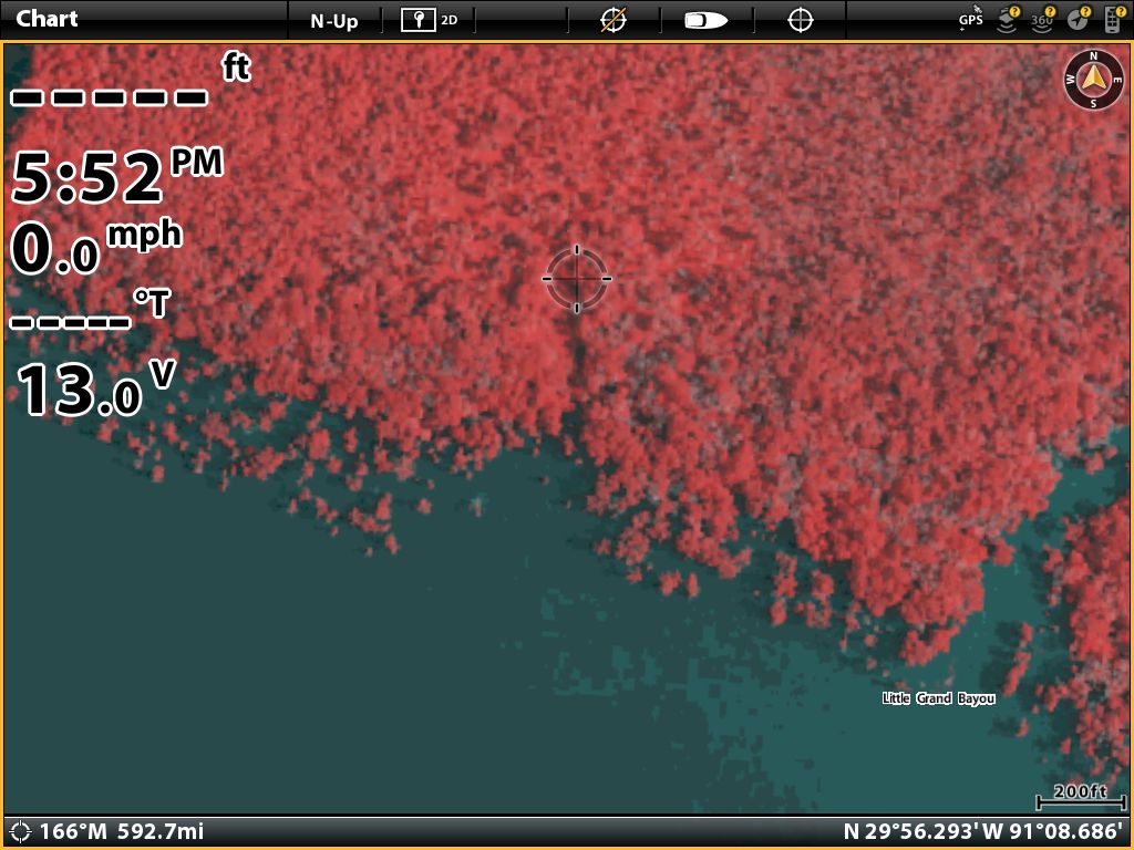
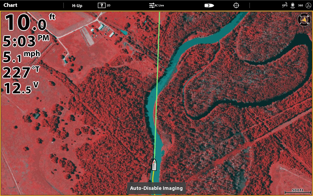
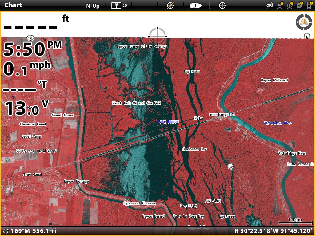
    Humminbird LakeMaster Satellite Imagery for the LA Coastal Card now highlights the Land and non-water in red to make it easier to view. I have had the chance to use this card on both the Atchafalaya Basin Area and West Louisiana and East Texas around Orange, Texas and here are a few images that show the advantages of the new highlight and details.

    You can see here it highlight each individual Cypress Tree


    Here is shot from West Texas in Taylor Bayou near Port Arthur and still had coverage


    Henderson Lake is top of coverage near I-10

    --


    http://www.dougvahrenberg.com/

    BASS Central Open- Competitive Bass Angler and Humminbird Guru
    Visit my website to learn about my sponsor's products, fishing tips and techniques.

    Learn More About Humminbird Side Imaging Visit: http://groups.yahoo.com/group/sideimaginggroup/

  14. Member Bob B's Avatar
    Join Date
    Nov 2010
    Location
    Creve Coeur, IL
    Posts
    2,914
    #14
    Doug Who ??? !!! Welcome back.
    __________________________________________________ ___

    **Looking for the one that makes it all worthwhile**
    __________________________________________________ ___

    Units ..... 1197 (6.310) ...1198 (6.490) ... Helix 12 MSI G3N

  15. Member Doug Vahrenberg's Avatar
    Join Date
    Sep 2005
    Location
    Higginsville, MO
    Posts
    12,741
    #15
    Here is a couple comparisons that show why LakeMaster added the Red Highlight to make it easier to quickly see the difference between land & water... Sure makes it easy to find the Run Outs too!


    --


    http://www.dougvahrenberg.com/

    BASS Central Open- Competitive Bass Angler and Humminbird Guru
    Visit my website to learn about my sponsor's products, fishing tips and techniques.

    Learn More About Humminbird Side Imaging Visit: http://groups.yahoo.com/group/sideimaginggroup/

  16. Member Doug Vahrenberg's Avatar
    Join Date
    Sep 2005
    Location
    Higginsville, MO
    Posts
    12,741
    #16
    Here is Coverage in East Texas around Port Arthur and Orange from the same Louisiana Card plus it adds offshore chart data: Red Highlight is Current Version


    Taylor Bayou Area and shows the accuracy of the Aerial Charts


    --


    http://www.dougvahrenberg.com/

    BASS Central Open- Competitive Bass Angler and Humminbird Guru
    Visit my website to learn about my sponsor's products, fishing tips and techniques.

    Learn More About Humminbird Side Imaging Visit: http://groups.yahoo.com/group/sideimaginggroup/

  17. Member Doug Vahrenberg's Avatar
    Join Date
    Sep 2005
    Location
    Higginsville, MO
    Posts
    12,741
    #17
    Bayou Black & Venice Area and How Red Highlight can help distinguish the Land Quickly


    --


    http://www.dougvahrenberg.com/

    BASS Central Open- Competitive Bass Angler and Humminbird Guru
    Visit my website to learn about my sponsor's products, fishing tips and techniques.

    Learn More About Humminbird Side Imaging Visit: http://groups.yahoo.com/group/sideimaginggroup/

  18. Member Doug Vahrenberg's Avatar
    Join Date
    Sep 2005
    Location
    Higginsville, MO
    Posts
    12,741
    #18
    East Louisiana Coverage Example and how the Red Highlight helps enhance the land


    --


    http://www.dougvahrenberg.com/

    BASS Central Open- Competitive Bass Angler and Humminbird Guru
    Visit my website to learn about my sponsor's products, fishing tips and techniques.

    Learn More About Humminbird Side Imaging Visit: http://groups.yahoo.com/group/sideimaginggroup/

  19. Member
    Join Date
    Jul 2010
    Location
    Big Sandy, TX
    Posts
    648
    #19
    Still curious what aerial image format Humminbird uses? Could someone look in the SD-card's aerial image folder for the file-types?

  20. Bass Hunter Rick1067's Avatar
    Join Date
    May 2008
    Location
    Ft. Mitchell, AL (Unfortunately)
    Posts
    597
    #20
    Doug, tried to PM you a question but your PM’s are full. Please PM me.

Page 1 of 2 12 LastLast