


This will compile all the LakeMaster Lake Lists, Screen Captures and Features in one place for easier viewing. If you have questions start a new thread and we can discuss.
LakeMaster Exclusive Features:
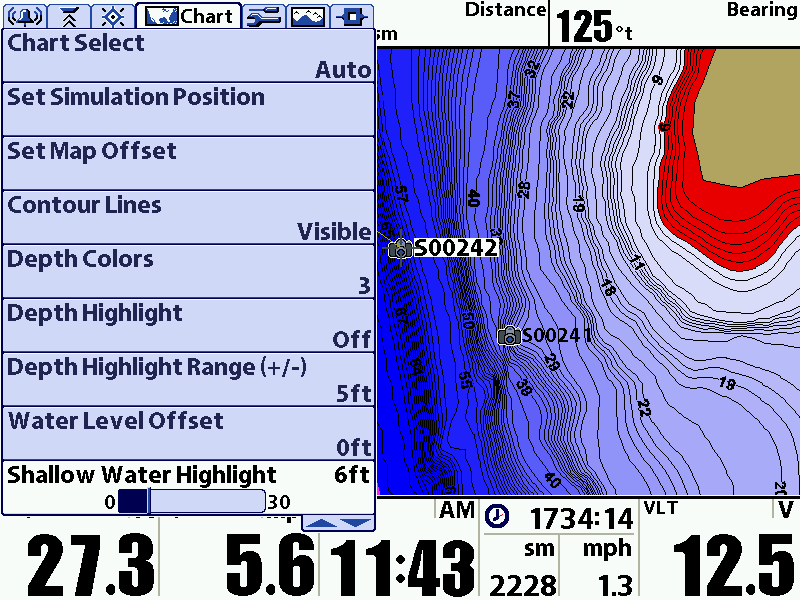
Water Level Offest:
Allows you to adjust the Map Contours to match the current Lake Level. Easiest way is to zoom into a contour line and match to your current sonar readings...this will get you real close.
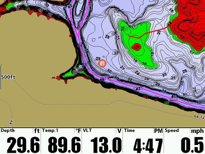
Shallow Water Highlight (Red)
Shallow Water Highlight allows you color from the bank to the selected depth a Red Color to help you select a hazard depth range or to select an upper range like when hump hunting.
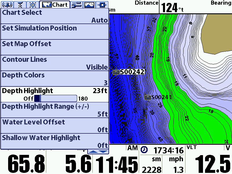
Depth Highlight (Green):
Depth Highlight Allows you to Highlight a Depth. Like the Depth Range you are looking for fish in or structure at that Depth. It will Highlight this Depth with a Green Line. Using with Depth Highlight Range will color that depth Above and Below that Range.
Depth Color:
Allows you to change the map colors for depth of the water. Darker Colors are deeper water or you can can turn them off.
Lake List:
You can search available Lakes by Name or HD Maps. Allows you to quickly go to that lake to look at the contour line data.
Turn Contour Lines OFF/ON:
You have the ability to view the Maps with Contour Lines on or off. Turning them off allows you to see the INFO Buttons, Roads, Channels and added data easier.
LakeMaster Videos:
LakeMaster Exclusive Features
Easy Way to Set Water Level Offset
Using GPS Mapping Features to Help Catch More Fish


 Reply With Quote