Do you really have to have the lake om the SD-card with zero lines for this to work? Can't you draw your own zerolines as you could in DrDepth? The biggest question of all, will it work and come out here in Europe as well?


Do you really have to have the lake om the SD-card with zero lines for this to work? Can't you draw your own zerolines as you could in DrDepth? The biggest question of all, will it work and come out here in Europe as well?


Your questions would be best directed to LakeMaster. I would contact them at www.lakemap.com they will know what the future and opportunities for International Customers.Originally Posted by Team CTM

--
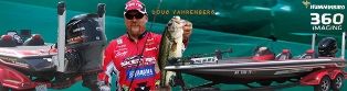
http://www.dougvahrenberg.com/
BASS Central Open- Competitive Bass Angler and Humminbird Guru
Visit my website to learn about my sponsor's products, fishing tips and techniques.
Learn More About Humminbird Side Imaging Visit: http://groups.yahoo.com/group/sideimaginggroup/

I want to get a mapping card for my Humming bird with a detail map of the lower end of the Pascagoula river. I am not that concerned with the depth and contour as I am concerned with having a map that will help while running in fog.
Chris Smith
2022 BC Bobcat
150 ProXs

I don't thank I would trust any map in heavy fog much over idle speed. Other boats, logs and what ever will not show up on any gps map. Only radar will show you other boats but not logs. Just my $.02
12 lbs 9 oz caught on 4/28/1975 Lake Eufaula
Pascagoula is not covered at this time but you can request the fishery to be considered for future survey. http://www.lakemap.com/Request-a-Lake/#.UkpBY74o45s
--
http://www.dougvahrenberg.com/
BASS Central Open- Competitive Bass Angler and Humminbird Guru
Visit my website to learn about my sponsor's products, fishing tips and techniques.
Learn More About Humminbird Side Imaging Visit: http://groups.yahoo.com/group/sideimaginggroup/
West Coast Anglers...LakeMaster now offers mapping for Arizonia, California, Colorado, Idaho, Montana, New Mexico, Nevada, Oregon, Utah, Washington and Wyoming HB Chart Western States (AZ CA CO ID MT NM NV OR UT WA WY) - Version 1
--
http://www.dougvahrenberg.com/
BASS Central Open- Competitive Bass Angler and Humminbird Guru
Visit my website to learn about my sponsor's products, fishing tips and techniques.
Learn More About Humminbird Side Imaging Visit: http://groups.yahoo.com/group/sideimaginggroup/
Western States Examples: http://www.bbcboards.net/humminbird-...ml#post4095155
--
http://www.dougvahrenberg.com/
BASS Central Open- Competitive Bass Angler and Humminbird Guru
Visit my website to learn about my sponsor's products, fishing tips and techniques.
Learn More About Humminbird Side Imaging Visit: http://groups.yahoo.com/group/sideimaginggroup/
I have the chip for nebr. and one of the "HD" lakes is lake Cunningham and there is no way in hell that they surveyed that lake, what they present is not even close. I have been all over that lake many times . If you use HD as a selling point it needs to really be "surveyed"
mark
Will take a look. But if you have concerns send LakeMaster the coordinates so they can investigate. They are actively surveying and are working to build the Best Maps money can buy and sure they want to look at resolving your concerns. http://www.lakemap.com/Contact-Support/#.Umab0Rco670
--
http://www.dougvahrenberg.com/
BASS Central Open- Competitive Bass Angler and Humminbird Guru
Visit my website to learn about my sponsor's products, fishing tips and techniques.
Learn More About Humminbird Side Imaging Visit: http://groups.yahoo.com/group/sideimaginggroup/
Bought my card today doug.
I've only been able to use it in sim mode. Been checking out the HD maps of the lakes and they look amazing. Curious about the legend though. I imagine the asterisks are structure/brush piles? I see a lot of white boxes, not sure what those represent? Should be using it for the first time monday/tuesday. Cant wait!
Move the cursor over those symbols and hit the Check Mark (Info) button and it wil ltell you exactly what they are the depth and GPS Locations. Here is a key to several of the symbols on the map.
http://www.lakemap.com/uploadedFiles...ymbols_Key.pdf
--
http://www.dougvahrenberg.com/
BASS Central Open- Competitive Bass Angler and Humminbird Guru
Visit my website to learn about my sponsor's products, fishing tips and techniques.
Learn More About Humminbird Side Imaging Visit: http://groups.yahoo.com/group/sideimaginggroup/

Doug, any idea when they will be releasing the NC version?
I have don't heard anything official of new lakes or new areas that will be added. Normally LakeMaster releases or announces in First Quarter of each year the New Lakes and New Regions. I do know their intention is nationwide coverage. As soon as I hear anything official I will post the information.
--
http://www.dougvahrenberg.com/
BASS Central Open- Competitive Bass Angler and Humminbird Guru
Visit my website to learn about my sponsor's products, fishing tips and techniques.
Learn More About Humminbird Side Imaging Visit: http://groups.yahoo.com/group/sideimaginggroup/
Thanks Doug..mnot sure ow longmit takes them to interpet their sonar outtings but I donknow they were in our area lakes at the beginningmof the year..
Standing by, Dave
Well I guess I should not look for a zero line mapping card under the Christmas tree. Any word on when they will release this mapping card. They showed it in June but still not for sale?
Rajun Cajun
Johnson 1995 #J130TLEOP
S# GO3872031
The AutoCharts will probably be Spring before release. You can start making recording to a blank SD Card anytime and be ready as soon as the AutoCharts are released.
--
http://www.dougvahrenberg.com/
BASS Central Open- Competitive Bass Angler and Humminbird Guru
Visit my website to learn about my sponsor's products, fishing tips and techniques.
Learn More About Humminbird Side Imaging Visit: http://groups.yahoo.com/group/sideimaginggroup/
Doug:
You should know that not all the lakes are actually being surveyed by Lakemaster. Some of the lakes they put out for sale were surveyed by other people and then purchased by Lakemaster.
I know that the lakes I fish all the time were surveyed by the Indiana Department of Natural Resources Fish and Wildlife Division. I actually saw and talked to the lady and guy doing the survery of my lake a few years before Lake Master came out with the IN/OH map of my lake. For reference I'm talking about Bluegrass Pit in Warrick County, IN and Otter Pit in Warrick County, IN. both these lakes are within 10 minutes of my house and I fish then a lot.
Regards,
Moose1am
LakeMaster does purchase some data but they are also very active with their own survey fleet of Surveyors and will note on the lake list the lakes their Survey Crews Survey. I know they have been very, very busy collecting data all over the USA and we should see many new LakeMaster Collected Data Lakes in the near future when 2014 Lakes are released.
All data whether purchased or actual surveys are processed by LakeMaster to create the added features and LakeMaster Method of Cartography.
--
http://www.dougvahrenberg.com/
BASS Central Open- Competitive Bass Angler and Humminbird Guru
Visit my website to learn about my sponsor's products, fishing tips and techniques.
Learn More About Humminbird Side Imaging Visit: http://groups.yahoo.com/group/sideimaginggroup/
I just ordered the Minn Kota Terrova 80 Us2 60" I-Pilot Link I have a HB 998 fishfinder.
I fish. Flaming Gorge Reservoir Utah/WY
Brown Trout, Burbot, Channel Catfish, Crayfish, Kokanee Salmon, Mackinaw (Lake Trout), Rainbow Trout, Smallmouth Bass
Do I need to wait to buy the Lake Master Auto Charts to come out, are will the Western States Lake master work.
follow any depth contour looks good to me.


Have you checked the waters included with the Western edition to see if it has the coverage you want?
HB Chart Western States (AZ CA CO ID MT NM NV OR UT WA WY) - Version 1
Wayne Purdum
Charlottesville, Va.
Helix 12 CHIRP MEGA+ SI G3N/G4N, Helix 15 CHIRP MEGA SI+ GPS G4N
SOLIX 12 SI/G3, Helix 8 CHIRP MEGA SI+ G4N, Ultrex 80/LINK, MEGA360,
MEGA LIVE, LIVE TL


 Reply With Quote